
This method is quick and easy to learn and apply.
This tool was developed as an implementation of Dizdaroglu and Yigitcanlar (2014). The idea is simple – create a spatial visual representation of a sustainability issue assessment. The GIS implementation is relatively easy. Identify the parcel(s) which you want to assess then add a fishnet (grid in GIS language). The image below shows an example of looking at the impervious surface at Eden Hall Campus. The road bisecting the campus, buildings and other hard surfaces are indicated in red, orange and yellow. The colors indicate the degree of imperviousness.
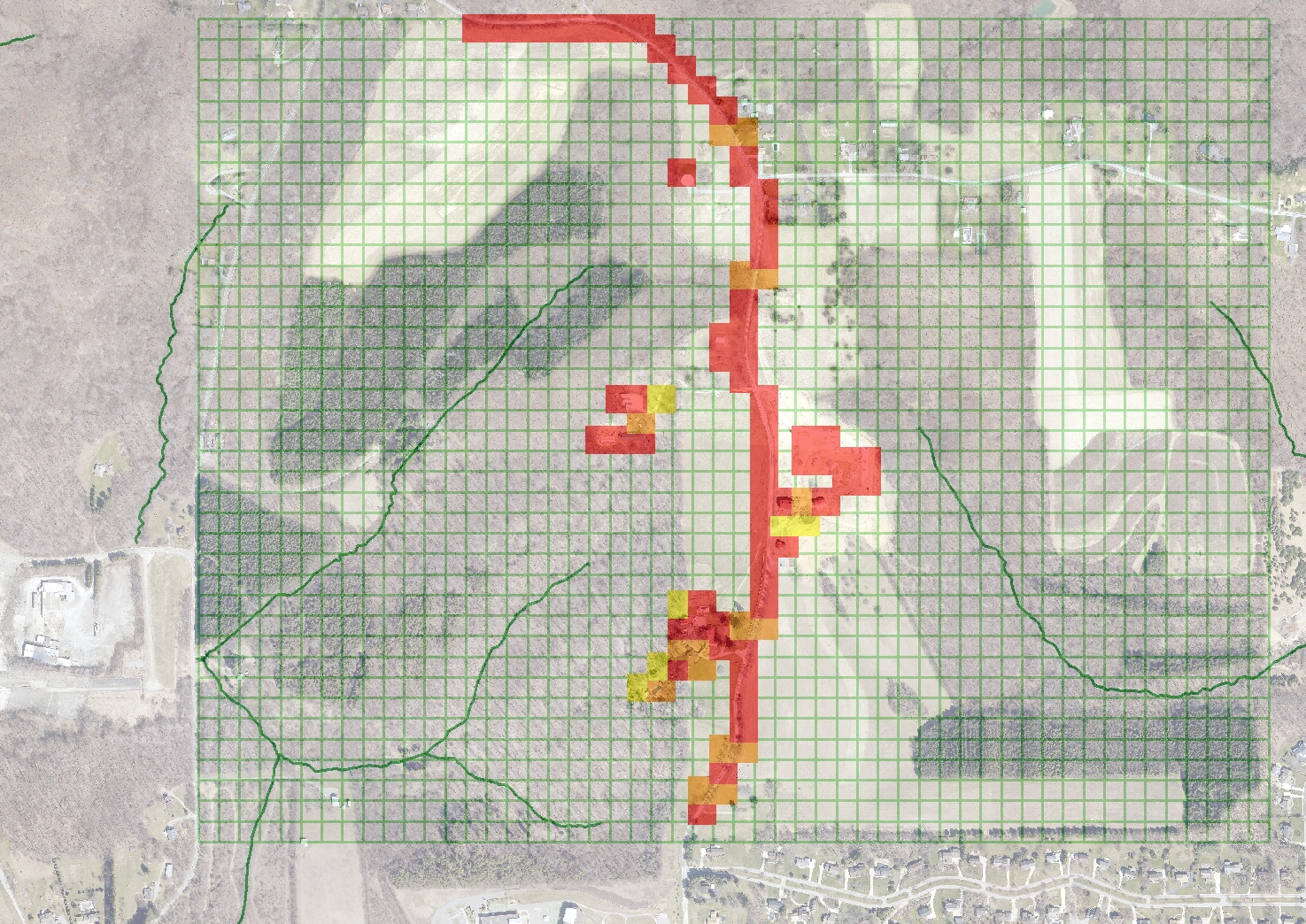
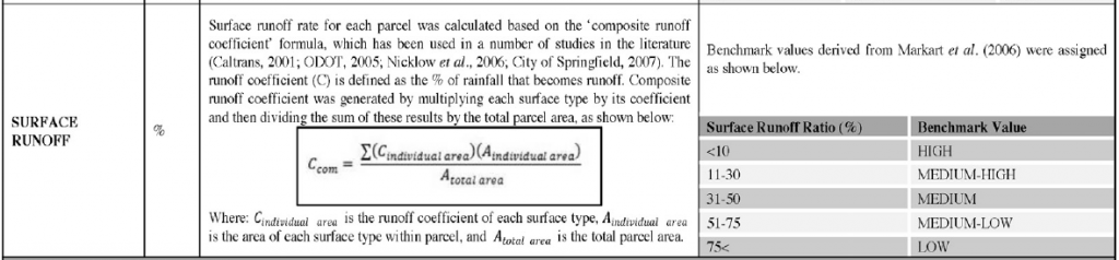
The big challenge is determining how to rank an issue to create an assessment. Dizdaroglu and Yigitcanlar use a panel of experts to develop their measures. Below is an example of one criterion. Looking at their examples it is easy to develop other approaches. The example above developed imperviousness as a measure rather than runoff. The implementation was intended to be used by a small group. Therefore the group develops the shared criteria for the 0 to 4 scale to measure imperviousness. In GIS, each cell in the fishnet (grid) is assigned a value between 0 and 4. The score is assigned colors (or a color gradient). 4 is red, two is yellow, 0 is without color (etc.).
The GIS implementation is presented in these slides.
Five Big Ideas
- Use GIS to communicate sustainability assessment
- A method for building a shared understanding of a problem and cooperation
- A method to less subjectively assess elements of wicked problems
- The methods can be applied to the current state or model potential scenarios.
- The approach can be built upon by adding additional layers of data in GIS.
In summary, the method is easy to use and a good starting point to using GIS to help make sustainability decisions. I say make, because the results and data do not make decisions. Results and data support people discussing and framing issues which ultimately leads to decisions.
References
Dizdaroglu, D. and T. Yigitcanlar (2014). “A parcel-scale assessment tool to measure sustainability through urban ecosystem components: The MUSIX model.” Ecological Indicators 41: 115-130.